Rain, fire danger, sun, thunderstorms: A mix of everything in North Texas weekend forecast
North Texas will see all four seasons this weekend and entering the following week.
Starting Friday night, Fort Worth had a 40% chance for rain, but that’ll change entering Saturday as the weekend is expected to be warm, sunny and dry.
“Scattered showers and perhaps a few storms will arrive in North Texas from the northwest (Friday) evening. Severe storms are not expected, but some gusty winds could accompany this activity,” the National Weather Service said. “All rain should be exiting the area to the east by early Saturday morning.”
With highs in the high 70s into mid 80s on the weekend, North Texas is prone to higher wildfire dangers, especially across the Big Country and western Hill Country, according to the weather service.
Wind gusts are expected to reach 15 to 25 mph Sunday afternoon with low humidity below 30%.
The weather service said the region is “drought-stricken,” and that this spring is expected to be drier than usual.
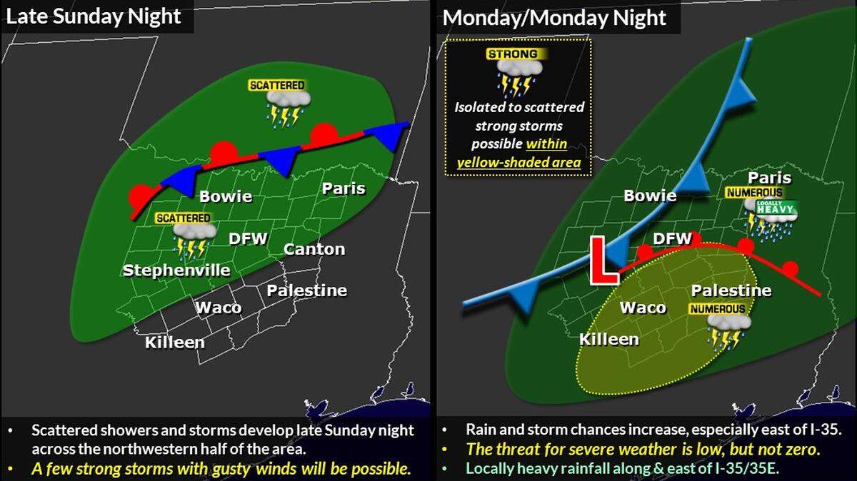
The summer-like weather will change again as potential storms are in the forecast for later Sunday night and will continue before the sun comes back out Tuesday.
“Scattered showers and storms develop late Sunday, and are expected to expand into the entire area Monday. The highest rain and storm chances arrive Monday night, especially east of the I-35 corridor,” the National Weather Service said. “The severe threat is low, but a few strong storms may develop where hail is the primary threat. In addition, locally heavy rainfall between 1-2 inches will be possible east of I-35 into East Texas.”
This story was originally published April 1, 2022 at 10:09 AM.