Icy conditions to worsen on North Texas roads with freezing temps, winter storm warning
Weather conditions Thursday are expected to be dangerous for travel and at best unpleasant: ice on roads and possible power outages because of ice on tree branches and power lines.
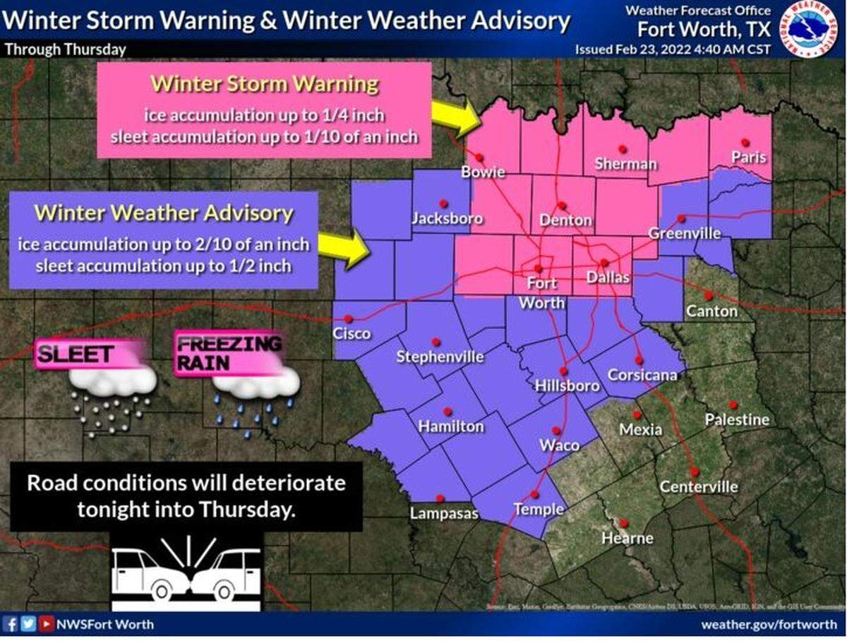
A winter storm warning is in effect until 6 p.m. Thursday for Tarrant County and several counties nearby, and a winter storm advisory is in effect for the rest of North Texas. The National Weather Service in Fort Worth expects heavier freezing rain and sleet overnight Wednesday and continuing on Thursday with temperatures in the 20s and 30s.
While ice on lines and branches may cause problems with power supply, the Electric Reliability Council of Texas said it doesn’t anticipate asking Texans to conserve power to prevent widespread outages.
The weather service expected up to .25 inches of ice to accumulate overnight into Thursday in North Texas.
Freezing rain is expected to arrive in the Tarrant County area by around 2 a.m. Thursday and continue until about noon until it begins to taper off. The high temperature is expected to climb just above freezing to about 35, according to the NWS.
Fort Worth police said Wednesday that most vehicle crashes they responded to during the day involved multiple vehicles and many were caused by icy conditions. Tracy Carter, a police spokesperson, said the department is asking people to help limit the number of accidents by staying off the roads unless it is absolutely necessary to drive.
The National Weather Service expects the worst driving conditions to last until 2 p.m. Thursday.
MedStar said it responded to 74 crashes, with nine of them being rollovers and 34 resulting in someone being taken to the hospital. Seventeen people were treated for falls caused by ice and seven patients treated for cold exposure. Three of the patients treated for cold exposure were taken to the hospital.
The cold weather also was affecting power, with 372 and 37 customers reporting outages in Dallas and Tarrant counties, respectively, according to Oncor’s power outage map.
Many school districts, including Fort Worth, have already canceled classes for Thursday, and hundreds of flights were canceled at Dallas-Fort Worth Airport. Tarrant County closed its 46 early voting locations at 5 p.m. Wednesday but hadn’t made a decision yet about Thursday’s voting schedule.
Wind chills Thursday are expected to bring what the temperatures feel like down into the teens.
In the warning, weather forecasters say there will be periods of freezing rain and freezing drizzle with ice accumulations. Road conditions will deteriorate late Wednesday into Thursday morning.
On Wednesday, elevated roads and bridges were becoming ice covered and there were patches of ice on other roads, already making travel dangerous in some places.
Officials with the Texas Department of Transportation said Wednesday that crews in the Fort Worth District were actively treating roadways, bridges, and overpasses 24/7. Those areas also were pretreated.
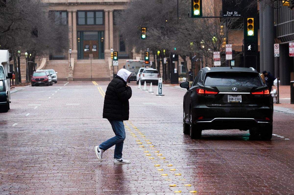
“This looks to be a freezing rain event, which is different than the last event we had,” said Val Lopez, a spokesman at the TxDOT Fort Worth District office, on Wednesday. “Freezing rain glazes on impact and is more difficult to drive on than sleet or snow.”
Lopez said motorists are encouraged to plan ahead by checking weather forecasts and visiting DriveTexas.org (or calling 800-452-9292) for the latest conditions and any road closures.
He noted that if North Texans must travel during inclement weather, they should remember to drive to conditions, slow down and be aware of other motorists. Here are other safety tips:
▪ Stay aware of weather conditions, as they can change rapidly.
▪ Give yourself additional time to reach your destination.
▪ Be considerate and share the road with others.
▪ Drive to conditions, wear your seat belt at all times, and don’t use cruise control.
▪ Reduce your speed and increase the traveling distance between your vehicle and others on the road.
▪ Drive with your headlights on day and night to increase visibility.
▪ Keep your vehicle’s gas tank full in case of unexpected delays.
▪ Give extra space to vehicles that may be parked on the side of the road.
▪ Move over a lane when possible if you see a vehicle with flashing lights on, such as a tow truck, law enforcement vehicle, emergency vehicle, or TxDOT vehicle.
▪ Give TxDOT vehicles space to work. Don’t follow too closely, don’t try and pass working roadway equipment, and remember — don’t crowd the plow.
North Texas toll roads on the LBJ Express, North Tarrant Express and NTE 35W are closed because of icy conditions, according to TxDOT officials. The closures were to begin by Wednesday afternoon.
A pileup crash of more than 100 vehicles in the I-35W toll lanes last winter killed six people and injured dozens.
North Texas police were already reporting several major traffic accidents on highways and roads on Wednesday morning and afternoon.
The Fort Worth Fire Department said on Twitter at 6:30 a.m. that the I-35W and Loop 820 interchange in North Fort Worth was being shut down due to ice, and the department was working eight accidents at that time. In at update at 7:45 a.m., the department said TxDOT would close the North Freeway Tollway Express lanes southbound and northbound, but that I-35 remained open in both directions.
“Roads may not be icy widespread but there are spots of ice,” the fire department said. “Drive with caution!”
As of 1:30 p.m. Wednesday., MedStar reported responding to 43 crashes since 3:30 a.m Wednesday, compared to 14 for the same time period on Tuesday. In Fort Worth, several 18-wheelers were involved in a major accident along with additional vehicles on the West Freeway in the eastbound lanes near Linkcrest Drive West. Four people were reported injured in that crash, according to MedStar.
MedStar also had responded to five ice-related falls and five patients treated for cold exposure.
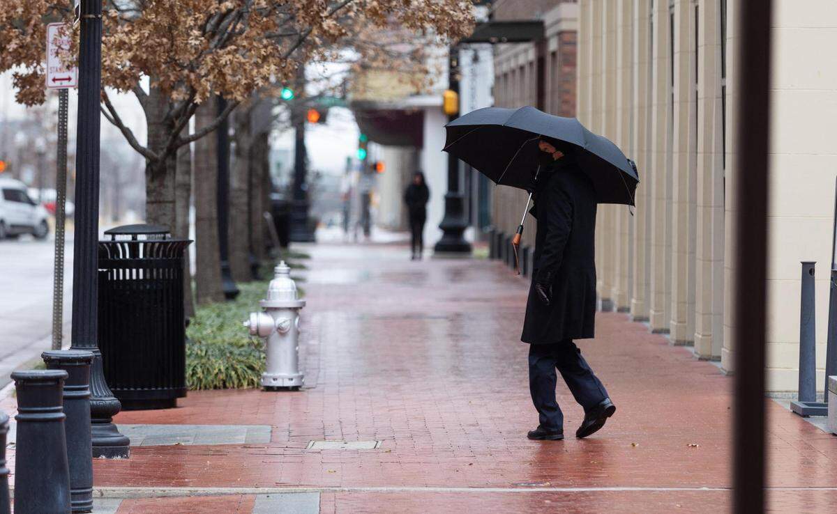
On social media, Grapevine police reported all bridges and overpasses were covered in ice Wednesday morning.
Isolated thunderstorms roamed through North Texas on Wednesday, giving highways and roads a soaking and setting up the freezing temperatures for icy conditions.
The high temperature on Wednesday was just in the upper 20s.
More freezing rain and sleet were in the forecast for Wednesday night. There’s an 80 percent of precipitation.
Sleet, freezing rain and isolated thunderstorms return on Thursday. Temperatures will be in the upper 30s. Chances of precipitation are at 90 percent on Thursday.
In true Texas weather, Friday should be mostly sunny with a high in the lower 40s.
Those warmer temperatures are expected to carry over to the weekend in DFW, with chances of rain Friday night into Saturday night. Overnight temperatures Friday are expected to dip as low as 34 degrees, with lows on Saturday night in the same neighborhood.
Sunday is expected to be dry, with highs in the 50s.
This story was originally published February 23, 2022 at 6:02 AM.