
Tornado watch alert issued for Dallas-Fort Worth area. Large hail expected with storms

Looking for the forecast for Thursday, May 9, 2024? Click here.
Earlier:
A tornado watch has been issued for North Texas counties including Tarrant, Denton, Collin and Dallas. The alert is in effect until 10 p.m. Wednesday.
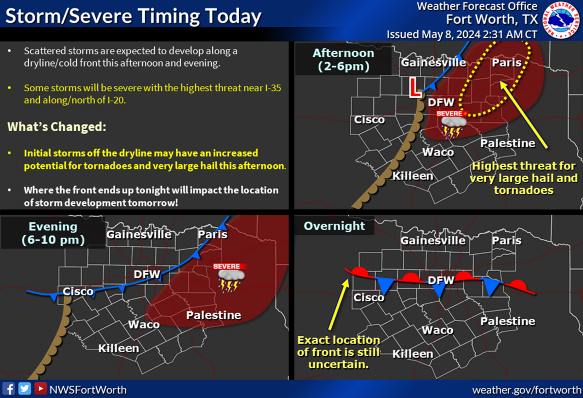
Very large hail and possible tornadoes cannot be ruled out as more storms move into Dallas-Fort Worth as early as mid afternoon Wednesday, according to the National Weather Service Fort Worth office.
The new storm front is moving east on a dry line, a boundary separating moist and dry air masses that tend to spawn severe weather, and is expected in North Texas between 2-6 p.m. along I-35 and north of I-20.
“Any storm that forms in this environment will quickly be able to become severe with large hail and damaging winds the primary threats,” Fort Worth meteorologist Allison Prater wrote on the NWS website. “Initial discrete storms off the dry line may have an increased tornado threat.”
.png "image (1).png")
Expect patchy fog and haze Thursday morning as storms exit east of the Metroplex. But more storms can roll in later in the day near the I-20 corridor and south into Central Texas, according to the weather service.
Before the storms and rain move in, the heat index values across much of North Texas will top 100 degrees. “[Wednesday] is probably going to be the warmest it’s felt all year long,” Fort Worth meteorologist Juan Hernandez told the Star-Telegram.
Storms blew through North Texas earlier this week bringing more rain to an already waterlogged region. Severe weather is common this time of year, a season when tornadoes are most likely to spawn. The weather service warns Texans to be aware of the weather.
This story was originally published May 8, 2024 at 12:50 PM.